Maps & Trail Information

Use the interactive map for planning your trip on the Tahoe Rim Trail, including trailhead locations, water sources, use regulations, and camping restrictions. The TRT’s total mileage evolves yearly as the TRTA works on trail projects to make the trail system more sustainable. 

For a tech-savvy way to map your trip, check out FarOut, the official app of the TRT. 

Free Segment Maps Download

Fill out your name and email address to download high-resolution segment maps for each of the eight segments and trail centerline files. Centerline files are available in large and small GPX files, KMZ files, and GIS shapefiles. 


Detailed Trail Segment Information

Tahoe City to Brockway Summit

20.5 Miles

Highlights

The serenity of Watson Lake, rugged lava formed cliffs and cinder cones, and beautiful views of the Truckee River Canyon.

Other Info

Big Views and Curious Lava Formations

Between Tahoe City and Brockway Summit, the Tahoe Rim Trail meanders through groves of fir, cedar and aspen and across open hillsides covered with manzanita. The trail climbs steadily from Tahoe City into a mixed forest. Side trails and open slopes offer opportunities to explore cinder cones and ancient lava flows. Midway between the trailheads the terrain flattens and a denser forest provides cool, quiet shade. The trail continues past the Lava Cliffs, a lovely overlook of Lake Tahoe and the peaks lining its north shore, before dropping down to Watson Lake. This shallow lake is thickly fringed with wildflowers in spring and early summer, and is a pleasant spot for fishing, picnicking and camping. Between Watson Lake and Brockway the trail crosses gently rolling slopes covered with a patchwork of small meadows and thick forests.

Brockway Summit to Mt. Rose Summit / Tahoe Meadows

20.2 Miles

Highlights

Tremendous panoramic views and the highest point on the TRT – Relay Peak

Other Info

Ascend to the Highest Point on the TRT

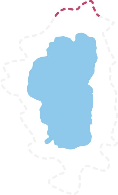
Between Brockway and Tahoe Meadows, the TRT winds through thick forests, open meadows, and across the feet of ancient volcanoes. In springtime fields of yellow mules ears sparkle against the backdrop of Lake Tahoe. This segment is prized for its spectacular windswept vistas of Lake Tahoe, the Sierra and the Carson Range.

The trail climbs away from Brockway for several miles and into thick and fragrant stands of pine, fir and tobacco brush. It crosses sun-splashed meadows where bright wildflowers are backed by distant lake views. The interior of the segment enters Nevada and the Humboldt-Toiyabe National Forest and treks along the volcanic summits and slopes of the Mt. Rose Wilderness and includes the highest point on the TRT, 10,338′ Relay Peak. Long ridge traverses afford horizon-spanning, nearly continuous views south across the entire Tahoe Basin and northwest over the Sierra to Mt. Lassen and beyond.

As the route leaves the Wilderness, crossing a saddle where the views change from the west to the east, a 0.7 mi spur trail ascends to the summit of 10,490′ Mt Houghton, offering expansive views in all directions. Continuing on, towering pines reappear to shelter the trail along its descent to the base of a 130′ waterfall, the highest on the trail.  Hikers pass the junction of the trail to the top of Mt. Rose, then continue to the parking lot at the Mt. Rose trailhead.

Mt. Rose Summit / Tahoe Meadows to Spooner Summit


24.1 Miles

Highlights

Christopher’s Loop (the most photographed section of the TRT) and Marlette Lake View

Other Info

Enjoy the Most Photographed Spot on the TRT

Between Tahoe Meadows (8740′) and Spooner Summit (7150′), the TRT roams high above sparkling Lake Tahoe and Marlette Lakes, through sun-warmed conifer stands, and across steep, flower-strewn slopes. This segment is celebrated for its magnificent views, stretching across Lake Tahoe and the high Sierra and past the jagged ranges of the Great Basin. The route is rich in historical reminders, skirting lakes and flumes built to supply water to distant miners on the Comstock. It traverses both dense forests that sprang up after clear-cutting a century ago, and ancient red fir stands spared the ax by their remoteness.

Between the lush grasses of Tahoe Meadows and Twin Lakes, the trail winds through rolling, wooded terrain. Breaks in the trees showcase grand vistas of the Tahoe Basin and Washoe Valley. The steeper, often open interior of the segment travels through Lake Tahoe Nevada State Park including possible side trips to North Canyon Campground and Marlette Lake. A TRT spur leads to Christopher’s Loop and a glorious cliff perch that seems to float above Lake Tahoe’s translucent shallows and Sand Harbor at the trail’s most photographed spot. The trail segment reaches its highest point as it threads between the bare rock of Snow Valley Peak (9214′) and shimmering aspen groves that turn North Canyon to gold each fall. Near Spooner Summit, the trail slips back into the pines, but still offers occasional panoramic lake and valley views.

Spooner Summit to Kingsbury South Connector


19.0 Miles

Highlights

Panoramic views of Lake Tahoe. Ancient fir trees.

Other Info

The Section for Tree Lovers – Ancient Firs and Expansive Aspen Groves

Shadowing the rugged peaks of the Carson Range, this trail segment weaves between the huge trunks of ancient firs and over sun-splashed granite outcrops. Ridge top crossings showcase panoramic views of the Tahoe Basin and Carson Valley. Open stands of Jeffrey pine alternate with the cool stillness of red fir forests and the cheerful rustlings of aspen groves. A diverse array of birds and small animals inhabit the area and alert hikers may catch a glimpse of marmots frolicking across boulders or coyotes and mule deer slipping between the trees.

From Spooner Summit (7150′), the trail switchbacks upward through fragrant conifers and across small meadows brightened in spring by the cheerful yellow blooms of mule’s ear. Nearby stand aspens whose broad trunks bear inscriptions carved long ago by lonely Basque Shepherds. A long traverse up the volcanic flanks of South Camp Peak (8866′) leads to the highest point on the segment (8830′) and a stunning view that sweeps across the entire length of Lake Tahoe. Along the descent to Kingsbury, dense woods occasionally part to reveal glimpses of sparkling water framed between the branches of lush firs. Just south of South Camp Peak, a dirt road crosses the TRT and rises steeply to the top of Genoa Peak (9150′), overlooking Carson Valley.

Kingsbury South Connector to Big Meadow

22.9 Miles

Highlights

Passes under the highest peak in the Tahoe Basin; Star Lake and exceptional trout fishing.

Other Info

Breathtaking Views of the Carson Valley and Star Lake

Between Kingsbury Grade South and Big Meadow, the trail follows the spine of the Carson Range from sun-drenched meadows to cool pine forests and windswept mountain passes. Starting at Kingsbury Grade the trail climbs through a dense forest of large red firs and white pines, majestic survivors of the Comstock logging era. Further south, open ridges and rocky outcrops showcase breathtaking views of the Carson Valley. Hemlock-ringed Star Lake offers inviting campsites and a nice fishing spot for brown trout. This secluded lake nestles at the feet of three of the highest mountain peaks in the Tahoe Basin, Freel Peak, Jobs Sister and Jobs Peak. The more rugged central portion of the segment weaves through monumental old growth junipers and across granite passes with stunning vistas of Lake Tahoe and the Sierra. From here the TRT descends gently south to the Big Meadow trailhead through forests and past small meadows dotted with flowers in the spring and summer and outlined with the golden shimmer of aspen leaves in the fall. Two miles before the end one can take a 0.6 mi shortcut to Grass Lake, an alternate trailhead.

Big Meadow to Echo Lakes


18.3 Miles

Highlights

Alpine lakes and open meadows with wildflower displays.

Other Info

Enter the Lakes Region

Between Big Meadow and Echo Summit, the trail wanders from meadows to lakes to creeks, and through dense stands of pine, fir and aspen. The trail heads south from Big Meadow trailhead across a gently rolling landscape of grassy meadows and fragrant conifer stands. The shaded shores of Round Lake is nestled beneath high cliffs. Further on, the TRT merges with the Pacific Crest National Scenic Trail (PCT) and swings north through flower filled Meiss Meadows and alongside the cool head waters of the Upper Truckee River. The trail then climbs past granite lined shores of Showers Lake and through a rocky bowl where seasonal creeks tumble down steep ridges into lush meadows. Further north the landscape becomes more rugged and much drier, and opens into occasional views of Lake Tahoe. The trail drops over a granite ridge in a long steep downhill traverse before leveling off. A small stream outlined with ferns and flowers provides a refreshing respite before the short ascent to the Echo Summit Trailhead.

Echo Lakes to Barker Pass

32.5 Miles

Highlights

Alpine lakes, wilderness setting and picturesque contrast of granite and water.

Other Info

Explore Desolation Wilderness

Between Echo Lake and Barker Pass, the trail leads deep into the granite heart of the Desolation Wilderness, where cool blue lakes lie cradled in ice-polished basins. The joint Tahoe Rim Trail/ Pacific Crest National Scenic Trail heads north from Echo Lakes across a rugged wilderness of glacial moraines and smooth granite ridges. Tumbling streams and serene lakes nourish pine groves and flower-filled meadows. The clear water and meandering shoreline of beautiful Lake Aloha offer delightful swimming and camping spots. The central portion of this segment is noted for its long steep approaches up and over Dicks Pass and for its equally breath-taking views. North of the pass, the Velma Lakes mark the trail’s entrance into a much drier and less open landscape, where thick conifer stands are interrupted by small meadows crowded with wildflowers. The gently rolling trail leads down out of Desolation Wilderness and eventually to shallow Richardson Lake. Several dirt roads cross the trail as it slowly rises to the Barker Pass trailhead. Small creeks and meadows punctuate the generally forested northern portion of the segment.

Barker Pass to Tahoe City


16.4 Miles

Highlights

Abundant wildlife, creeks and wildflowers and Page Meadow.

Other Info

West Shore Splendor

Between Barker Pass and Tahoe City the trail dips in and out of flowery meadows and swoops around craggy volcanic peaks. The joint Tahoe Rim Trail / Pacific Crest National Scenic Trail north of Barker Pass rolls across open hillsides decorated with wildflowers. Near Twin Peaks, the TRT splits from the PCT and turns east toward Lake Tahoe. The trail soon drops steeply into thickly wooded Ward Canyon, where the scent of pine and the rustling of aspen leaves fill the air. It then meanders for a few miles past a small waterfall and alongside a gurgling creek before climbing back out of the canyon. Close to Tahoe City, lush and lovely Page Meadows provide enchanting spring and summer wildflowers, vibrant fall color and year-round wildlife watching. The trail reenters the trees for a last downhill to the banks of the Truckee River and then the trailhead.